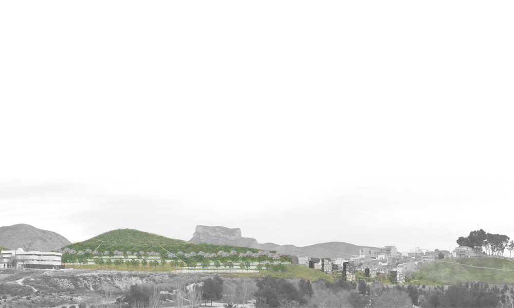
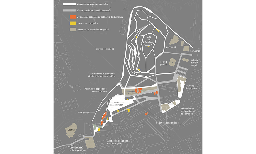
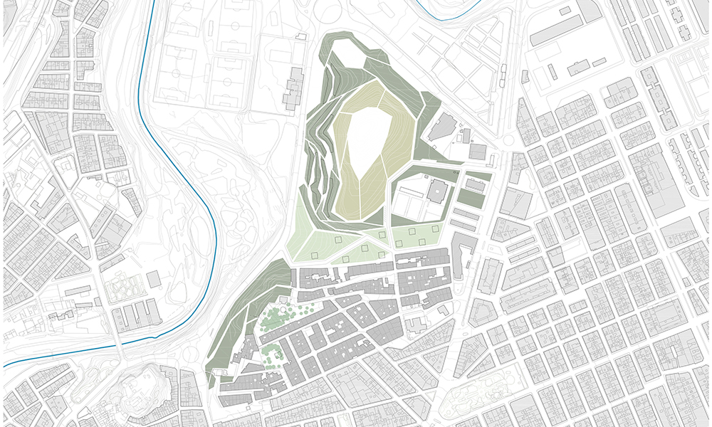
El emplazamiento está compuesto por tres zonas bien diferenciadas, con características morfológicas y topográficas diferentes. Al Sur, el barrio consolidado de Numancia, que culmina con el Alto de San Miguel, donde la convocatoria pide directrices de intervención para la mejora del barrio y prohíbe las demoliciones. Al norte, el Alto de Tafalera, un hito topográfico que ha de ser recuperado con operaciones de paisajismo y medioambientales. Y entre los dos altos, una vaguada actualmente ocupada por el barrio de Tafalera, un asentamiento marginal que el ayuntamiento tiene decidido demoler.
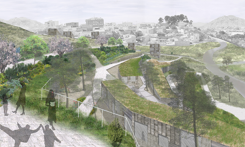
Estas tres situaciones diferenciadas requieren tres repuestas diferentes. En el barrio de Numancia no se permiten demoliciones y por tanto nos limitamos a proponer estrategias de recuperación urbana que catalizarán una transformación gradual, tales como inserción de equipamientos terciarios y viviendas de colmatación en los solares en ruinas. En el Alto de Tafalera proponemos un nuevo jardín urbano y un área de 47 viviendas aterrazadas en contacto directo con el parque (viviendas-ladera). En la vaguada proponemos un bulevar que conecta la zona urbana consolidada y los equipamientos situados al este (calle de Santa Barbara, colegios y residencia de ancianos) con el Parque del Vinalopó, situado al oeste. Este bulevar integra árboles, zonas de esparcimiento y 53 viviendas en mini-bloques de 4 y 5 plantas (viviendas-torre). Una red peatonal une las tres zonas con el Casco Antiguo de Elda y permite una total accesibilidad que contribuirá a la regeneración social del emplazamiento.
La propuesta en su conjunto ofrece así tres tipos de entornos cada uno de ellos con un tipo de vivienda. Las nuevas viviendas permitirán el realojamiento y evitarán la dispersión de las familias que siempre han vivido en Tafalera. Los tres tipos de entornos propuestos posibilitarán distintos modos de vida y facilitarán la diversificación social de una zona que hasta ahora ha sido un gueto para las estratos sociales más desfavorecidos.